|
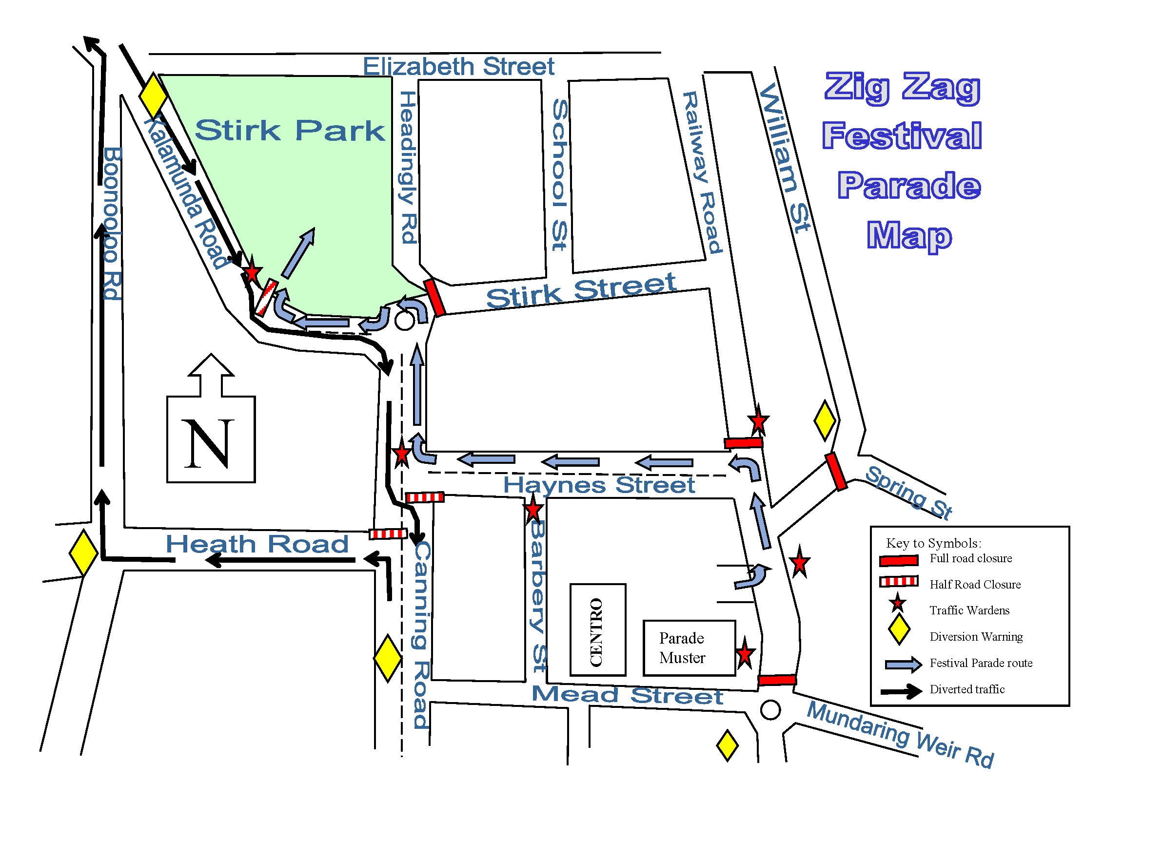
TEMPORARY ROAD CLOSURE
In accordance with
Section 3.50
of the Local Government Act 1995, notice is given that the following
streets will be temporarily affected by the Zig Zag Festival Parade on
Sunday October 30th, 2016:
- Spring
Road (full) from William Street to Railway Road 5:15-5:45pm.
- Railway
Road (full) from Haynes Street to Mead St. 5:15-5:45pm.
- Haynes
Street (full) from 5:20-6:10pm.
- Canning
Road (half- South bound) from Kalamunda Road to Haynes Road from
5:45-6:10pm. Traffic diversion via Heath Road & Boonooloo
Road or Elizabeth St.
- Kalamunda
Road (half) after car park entry, at Kalamunda Bowling Club, to Canning
Road 5:45–6:10pm.
|

 Community
Arts Inc.